-

Central New Mexico Commuter Rail Model
Planning Technologies has been closely involved with the Railrunner Express development program -- the "new start" commuter rail proposal for the central New Mexico corridor connecting Albuquerque and Santa Fe. Planning for this project is being led by the Mid-Region Council of Governments (MRCOG) working under the auspices of the New Mexico DOT. One of our contributions to this program was the development, calibration, and implementation of the multi-modal commuter rail mode split model for this travel corridor that spans the traditional modeling areas addressed by the two MPOs in Albuquerque and Santa Fe. This new corridor model integrated the databases from the travel models for the two MPO regions and supplemented them with commuting information drawn from the 2000 Census Journey to Work survey. Travel patterns associated with other trip purposes were synthesized from permanent traffic count station data and methods drawn from NCHRP 365. The new mode split model is a multinomial logit model addressing auto, bus, and commuter rail passenger traffic, and is implemented in the EMME/2 forecasting system.
Highway, transit, and HOV projections from the model were used successfully in the Alternatives Analysis phase of this study and later in the Environmental Assessment. Both documents have been approved and as of this writing the commuter rail line itself is under construction and scheduled to commence operations in late 2008.
-

Albuquerque Area Travel Demand Model
Planning Technologies was responsible for much of the programming and implementation of the Albuquerque Area Regional Travel Forecasting Model in 1996, still in use at the Mid-Region Council of Governments (MRCOG, the MPO) although it has been enhanced by various parties over the last 12 years. The model itself had been built and calibrated by others, but left in a "research" state. Our assignment in this engagement was essentially to make the model "operational" for continued use for regional planning. Our work included organizing the databases, streamlining the code, defining the file structures and file naming nomenclature, and supplementing model code with our own macros and batch files to drive the entire modeling sequence as a single executable thread. In addition, we implemented the trip generation model -- a customized C++ program that implements a cross-classification trip rate model which first ran on unix which we later ported to Windows. Nobody outside of MRCOG is more familiar with modeling practices in Albuquerque than we are.

AZSMART
Planning Technologies helped MAG (Maricopa Association of Governments, the MPO for the Phoenix metropolitan area) develop system specifications for the new land use and socioeconomic modeling system, AZSMART. This project will result in a new forecasting platform for both Phoenix, Tucson and other planning jurisdictions in Arizona. Ultimately, procedures and tools developed and exposed by this system will be of use to other MPOs around the country.
The AZSMART essentially envisions the fusion of capabilities offered by the current SAM-IM model in use at MAG with the Urbansim model developed on OPUS by the Center for Urban Simulation and Policy Analysis at the University of Washington. In this effort Planning Technologies has played an advisory and review role based on our extensive knowledge of the SAM-IM model and related methodologies that AZSMART will ultimately supplant. We helped detail the specifics of that vision -- defining model and software features, development strategy, GUI design, and database configuration. We developed an extensive library of technical documentation and specifications. At this writing, the actual implementation program being undertaken by the University of Washington for MAG is now well underway.
-

SAM Model Development, Enhancements, and Support
Planning Technologies is the developer of the SAM-IM model (Subarea Allocation Model and Information Manager), a completely GIS-based suite of applications and models for land use and socioeconomic forecasting for major metropolitan areas. At the crux of the model is a cellular based simulation of growth and development in a region leading to projections and maps predicting future land use. At the core of the growth simulation is a developer choice model calibrated from the history of development decisions that have been made in the region. Other key features of the system include land use editors needed to maintain existing and planned land use databases and inventories of developments underway in the region and a spatial calculator capable of generating and exporting zone-based data tables for land use and other exogenous descriptors of urban activity needed by travel forecasting programs (e.g., TAZ data sets for trip generation programs). The system, therefore, not only addresses the need for a viable forecasting methodology but also addresses the needs for tools to maintain and support the various databases intrinsic to the model.
The model has a rich history dating back over 10 years. It was originally developed in ArcInfo 7 for MAG (the Maricopa Association of Governments) in 1996 and was later redeployed in ArcView 3.x for MRCOG (Mid-Region Council of Governments). It has been the official regional land use forecasting model in both regions for over a decade and has recently been installed in Tucson for PAG (Pima Association of Governments). Over the years Planning Technologies has been engaged by these agencies to implement numerous enhancements and extensions, as well as to provide training and user support. To hear about other aspects of the SAM-IM modeling system, click here.

SGM-LTIM VMT Estimator
Maui County wanted a capability to estimate VMT (vehicle miles of travel) associated with alternative land use plans developed with the Spatial Growth Model (SGM) and Long Term Impact Model (LTIM) software from TerraSystems Southwest (Tucson, AZ). VMT was one of an array of indicators used to measure the level of sustainability associated with alternative futures. Our ArcView 3.x extension accomplished this by emulating the traditional four-step travel modeling process per methods prescribed in NCHRP 365 -- our own implementation of a quick response system made popular by the old "QRS Model" of the 1980s.
A unique and innovative feature of our application is that it performs full network analysis and path building on a casually drawn street network sketched on the screen and does not require a laboriously coded highway network database. Our VMT estimator generates its network database itself -- and does so by converting vector streets appearing in the sketch to a raster grid and then performs path building and other travel model functions in grid, stepping from point to point in the network as if it were a chessboard. We know of no other such approach in the profession. The model runs almost instantenously and thereby can capably support "what if" questions of land use policy.The "skim tree" engine that drives the VMT estimator ws developed as a VB6 application. VMT estimates are then derived from quick response model results and are depicted through a series of summary tables and thematic maps.
-

TRAM
Planning Technologies is also the author and developer of TRAM, the Transportation Access Model. This model provides a GIS based toolbox for analyzing the level of accessibility offered by transportation networks. Unlike conventional travel forecasting model which are limited to sketch networks of major roadways, TRAM works on fully detailed comprehensive network databases and therefore has sufficient detail to accurately address pedestrian and bicycle modes of travel. Further, the TRAM model analyzes the level of accessibility associated with transit networks the way they are really scheduled. It makes no heroic assumptions about presumed waiting times between buses, but follows actual published timetables. Accessibility measures are expressed in vivid illustrations of travel time contours from one or more focal points of interest and can be used to define service areas or market areas, for example around train stations. The model generates statistical summaries of population, jobs, and other measures of urban activity accessible to these points of interest. The TRAM model has played a major role in transit service studies, station location studies, and "walkability" of neighborhoods, to name some of its specific applications.
To learn more about the TRAM model, click here.

Travel Demand Forecasting Studies
Planning Technologies is frequently engaged to provide travel demand modeling support for various travel studies in the Albuquerque metropolitan area. By virtue of our long-standing relationship with the regional MPO MRCOG (Mid-Region Council of Governments) and our intimate knowledge of the travel demand forecasting model system there, we can provide timely assistance in support of other planning projects in the region. We have been responsible for providing travel forecasting support for various development impact studies over the years, including the 9,000 acre Mesa del Sol proposal, the Westlands master plan amendment, and development proposals for the southwest mesa in Albuquerque. We can often capitalize on special tools that we have developed to manage travel demand model datasets expeditiously (see M2Probe Network Editor) and analyze travel forecasting results (M2Probe), giving us an ability to efficiently and economically undertake travel demand forecasting assignments. We are intimately familiar with the operation of EMME/2, a major travel modeling platform from INRO Consultants, Inc, and are soon to become equally familiar with the operation of Cube from Citilabs as MRCOG completes its transition to it.

Downtown Parking Model
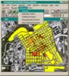
This Arcview 3.x extension provides Downtown Fort Worth, Inc, the economic development agency in Texas, with a capability to manage their inventory of downtown parking facilities. Planning Technologies developed this application to let users access and modify the land use database for the downtown, spatially oriented to city blocks. The model generates parking demand estimates for a variety of time periods, on both weekdays and on weekends, and in consideration of both short-term and long-term demand. The model can then estimate and illustrate deficiencies in the downtown with respect to both on-street and off-street parking capacity. In this project, Planning Technologies was responsible for developing the GIS software for a prime consultant. We implemented the model and its associated land use and parking databases and provided on-site installation and training.